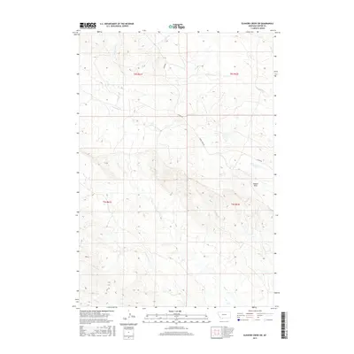
2017 Map of Elkhorn Creek SW
USGS Topo · Published 2017About this map
Watson Draw and a complex drainage system define this portion of Carter County, Montana. The landscape is etched by numerous seasonal watercourses, including Ninemile Cr, Twelvemile Cr, and S Indian Cr, which illustrate the erosion patterns of the northern Great Plains. These ephemeral streams converge toward larger arteries like Owl Cr and the S Fork Owl Cr in the southern sections of the survey. Human presence is sparse, marked primarily by the primitive routes of Albion Rd and Indian Creek Rd that follow the natural contours of the high prairie. The map provides a clear look at the Public Land Survey System grid through township boundaries like t8s r61e and t9s r62e, essential for researchers tracing specific land allotments or historic ranch boundaries in this corner of the state.
Find a feature on this map
15 named features on this map. Tap any name to fly to it.
Don’t see what you’re looking for? This feature index may not catch every label — zoom into the map to look around manually.
Map Details
Editions of this 2017 Elkhorn Creek SW Map
This is the sole edition of this map. No revisions or reprints were ever made.
Other maps of this area

1901 · Aladdin
USGS Topo · 1:125,000

1903 · Aladdin
USGS Topo · 1:125,000

1954 · Ekalaka
USGS Topo · 1:250,000

1954 · Gillette
USGS Topo · 1:250,000

1955 · Gillette
USGS Topo · 1:250,000

1956 · Ekalaka
USGS Topo · 1:250,000

1957 · Mona
USGS Topo · 1:62,500

1957 · Colony
USGS Topo · 1:62,500

1958 · Gillette
USGS Topo · 1:250,000

1958 · Ekalaka
USGS Topo · 1:250,000