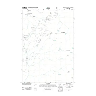
2011 Map of Elkhorn Hot Springs
USGS Topo · Published 2011About this map
The mining history of the Pioneer Mountains is recorded across this landscape, centered on the historic camps at Elkhorn and the recreational hub of Elkhorn Hot Springs. In the northern reach of the map, a dense network of extraction sites includes the Elkhorn Mill Mine, Ore Mill, and Old Elkhorn Mine, illustrating the intense industrial activity that once dominated the gulches near Aspen Mine. To the west, the landscape transitions toward Grasshopper Creek, where the Grasshopper Valley Fire Dept and Maverick Mountain RV Park mark more contemporary land use.
Find a feature on this map
61 named features on this map. Tap any name to fly to it.
Don’t see what you’re looking for? This feature index may not catch every label — zoom into the map to look around manually.
Map Details
Editions of this 2011 Elkhorn Hot Springs Map
This is the sole edition of this map. No revisions or reprints were ever made.
Other maps of this area

1893 · Dillon
USGS Topo · 1:250,000

1952 · Torrey Mountain
USGS Topo · 1:24,000

1952 · Ermont
USGS Topo · 1:24,000

1955 · Dillon
USGS Topo · 1:250,000

1957 · Dillon
USGS Topo · 1:250,000

1958 · Dillon
USGS Topo · 1:250,000

1958 · Vipond Park
USGS Topo · 1:62,500

1959 · Polaris
USGS Topo · 1:62,500

1962 · Dillon
USGS Topo · 1:250,000

1965 · Dillon
USGS Topo · 1:250,000