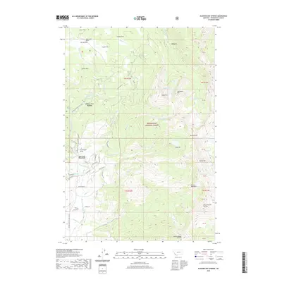
2020 Map of Elkhorn Hot Springs
USGS Topo · Published 2020About this map
Elkhorn Hot Springs serves as a focal point for this high-elevation landscape within the Beaverhead National Forest, where geothermal features meet the steep drainages of the Pioneer Mountains. The settlement pattern is defined by the Pioneer Mountains Scenic Byway, which provides access to recreational landmarks like Crystal Park and the slopes of Maverick Mountain. Throughout the Grasshopper Valley, numerous creeks such as Grasshopper Cr and Shale Cr carve through the terrain, while the heights are punctuated by prominent peaks including Saddleback Mtn and Comet Mtn. The map preserves the names of numerous mountain lakes, from Dingley Lakes to the remote Sawtooth Lake, illustrating the complex glacial topography of the region. Local names like Saint Louis Gulch and Sheldon Park suggest a history of early prospectors and ranchers who navigated these rugged mountain corridors.
Find a feature on this map
76 named features on this map. Tap any name to fly to it.
Don’t see what you’re looking for? This feature index may not catch every label — zoom into the map to look around manually.
Map Details
Editions of this 2020 Elkhorn Hot Springs Map
This is the sole edition of this map. No revisions or reprints were ever made.
Other maps of this area

1893 · Dillon
USGS Topo · 1:250,000

1952 · Torrey Mountain
USGS Topo · 1:24,000

1952 · Ermont
USGS Topo · 1:24,000

1955 · Dillon
USGS Topo · 1:250,000

1957 · Dillon
USGS Topo · 1:250,000

1958 · Dillon
USGS Topo · 1:250,000

1958 · Vipond Park
USGS Topo · 1:62,500

1959 · Polaris
USGS Topo · 1:62,500

1962 · Dillon
USGS Topo · 1:250,000

1965 · Dillon
USGS Topo · 1:250,000