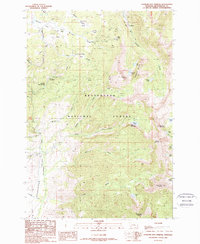
1988 Map of Elkhorn Hot Springs
USGS Topo · Published 1989About this map
Elkhorn Hot Springs serves as a focal point for this high-elevation landscape within the Beaverhead National Forest, where thermal springs meet a legacy of hard-rock mining. The map documents the industrial footprint of the Pioneer Mountains, notably the Old Railroad Grade and the settlement of Coolidge, which supported local extraction efforts. Mining activity is widespread, marked by the Park Mine, Magna Mine, and numerous Mine Shaft locations and Prospects scattered across the slopes of Comet Mountain.
Find a feature on this map
51 named features on this map. Tap any name to fly to it.
Don’t see what you’re looking for? This feature index may not catch every label — zoom into the map to look around manually.
Map Details
Editions of this 1988 Elkhorn Hot Springs Map
This is the sole edition of this map. No revisions or reprints were ever made.
Other maps of this area

1893 · Dillon
USGS Topo · 1:250,000

1952 · Torrey Mountain
USGS Topo · 1:24,000

1952 · Ermont
USGS Topo · 1:24,000

1955 · Dillon
USGS Topo · 1:250,000

1957 · Dillon
USGS Topo · 1:250,000

1958 · Dillon
USGS Topo · 1:250,000

1958 · Vipond Park
USGS Topo · 1:62,500

1959 · Polaris
USGS Topo · 1:62,500

1962 · Dillon
USGS Topo · 1:250,000

1965 · Dillon
USGS Topo · 1:250,000