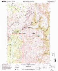
1997 Map of Elkhorn Hot Springs
USGS Topo · Published 2002About this map
The high alpine mining camps and recreational retreats of the Pioneer Mountain range are recorded in this late-century revision within the Beaverhead National Forest. This landscape is defined by the legacy of extraction, centered on the Old Elkhorn Mine and the remnants of Coolidge, alongside numerous Adits, Prospects, and the Magna Mine. These industrial signatures contrast with the established seasonal life at Elkhorn Hot Springs, where the Elkhorn Hot Springs Guard Station and nearby Ski Lift indicate the area's transition into a destination for mountain leisure.
Find a feature on this map
67 named features on this map. Tap any name to fly to it.
Don’t see what you’re looking for? This feature index may not catch every label — zoom into the map to look around manually.
Map Details
Editions of this 1997 Elkhorn Hot Springs Map
This is the sole edition of this map. No revisions or reprints were ever made.
Other maps of this area

1893 · Dillon
USGS Topo · 1:250,000

1952 · Torrey Mountain
USGS Topo · 1:24,000

1952 · Ermont
USGS Topo · 1:24,000

1955 · Dillon
USGS Topo · 1:250,000

1957 · Dillon
USGS Topo · 1:250,000

1958 · Dillon
USGS Topo · 1:250,000

1958 · Vipond Park
USGS Topo · 1:62,500

1959 · Polaris
USGS Topo · 1:62,500

1962 · Dillon
USGS Topo · 1:250,000

1965 · Dillon
USGS Topo · 1:250,000