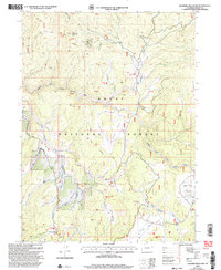
2000 Map of Elkhorn Mountain
USGS Topo · Published 2004About this map
Elkhorn Mountain and the surrounding high-altitude terrain dominate this segment of the Routt National Forest, where the landscape is defined by resource extraction and forest management. The presence of the Elkhorn Mine along with various prospects and prospect pits indicates an era of active mineral exploration. The regional infrastructure is specialized, featuring the Elkhorn Stock Driveway and the Elkhorn North Stock Driveway, which highlight the historical importance of seasonal livestock movement through these mountains.
Find a feature on this map
44 named features on this map. Tap any name to fly to it.
Don’t see what you’re looking for? This feature index may not catch every label — zoom into the map to look around manually.
Map Details
Editions of this 2000 Elkhorn Mountain Map
This is the sole edition of this map. No revisions or reprints were ever made.
Other maps of this area

1911 · Hahns Peak
USGS Topo · 1:125,000

1913 · Hahns Peak
USGS Topo · 1:125,000

1932 · Savery
USGS Topo · 1:96,000

1939 · Saratoga
USGS Topo · 1:125,000

1940 · Savery
USGS Topo · 1:125,000

1954 · Rawlins
USGS Topo · 1:250,000

1954 · Craig
USGS Topo · 1:250,000

1957 · Craig
USGS Topo · 1:250,000

1958 · Rawlins
USGS Topo · 1:250,000

1958 · Craig
USGS Topo · 1:250,000