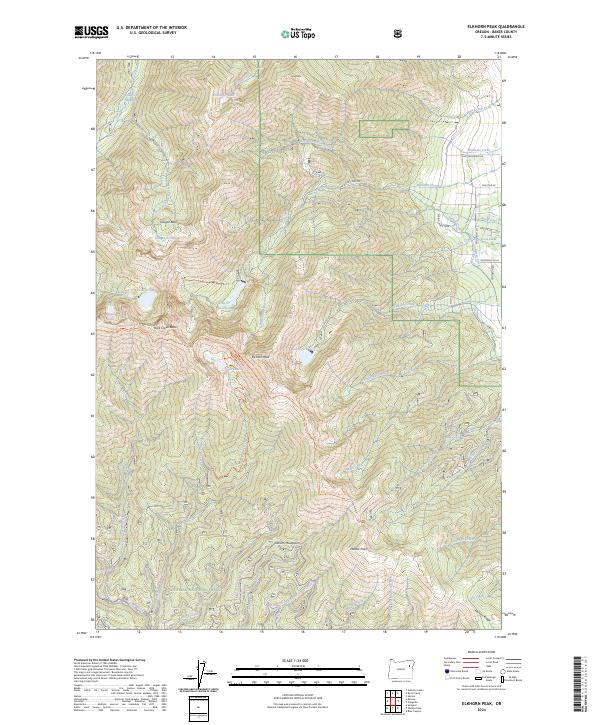
2024 Map of Elkhorn Peak
USGS Topo · Published 2024About this map
Elkhorn Peak and the high summits of the Elkhorn Mountains dominate this high-elevation landscape within the Whitman National Forest. The map documents a complex network of alpine water management and recreational access, featuring numerous named water bodies like Willow Cr Lake, Rock Cr Lake, and Goodrich Lake. These basins are linked by a system of man-made waterways including Williams Ditch and Nelson Ditch, illustrating the historic diversion of snowmelt for lower-elevation agricultural or mining use.
Find a feature on this map
64 named features on this map. Tap any name to fly to it.
Don’t see what you’re looking for? This feature index may not catch every label — zoom into the map to look around manually.
Map Details
Editions of this 2024 Elkhorn Peak Map
This is the sole edition of this map. No revisions or reprints were ever made.
Other maps of this area

1901 · Baker City
USGS Topo · 1:125,000

1901 · Sumpter
USGS Topo · 1:125,000

1955 · Baker
USGS Topo · 1:250,000

1955 · Canyon City
USGS Topo · 1:250,000

1959 · Baker
USGS Topo · 1:250,000

1959 · Canyon City
USGS Topo · 1:250,000
1967 · Haines
USGS Topo · 1:24,000

1967 · Blue Canyon
USGS Topo · 1:24,000
1967 · Wingville
USGS Topo · 1:24,000
1972 · Elkhorn Peak
USGS Topo · 1:24,000