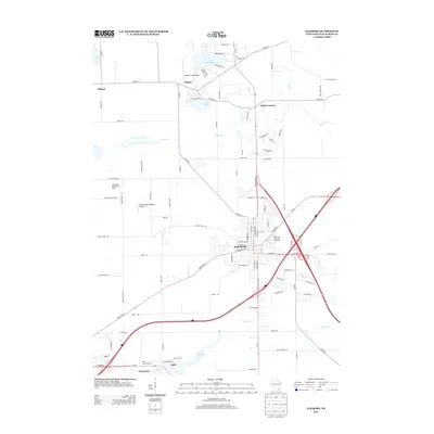
2013 Map of Elkhorn
USGS Topo · Published 2013About this map
Elkhorn serves as a central hub in this Southern Wisconsin landscape, dominated by a mix of agricultural heritage and modern aviation. The city is notably home to the Walworth County Fair Grounds, a significant regional landmark situated near the junction of several major transport routes. Surrounding the urban center, the terrain is defined by water bodies like Lake Wandawega and Silver Lake, while the southern edge of the sheet reaches the northern shores of Delavan Lake. This era shows a distinctive concentration of small aviation facilities, including Paddock Field Airport, Weedhopper Meadow Airport, and Lake Lawn Airport, suggesting a localized culture of private flying. Rural life and local commerce are represented by the Apple Barn Orchard And Winery and older crossroads settlements such as Millard, Tibbets, and Abells Corners, which maintain their identity amidst the winding paths of Sugar Cr.
Find a feature on this map
98 named features on this map. Tap any name to fly to it.
Don’t see what you’re looking for? This feature index may not catch every label — zoom into the map to look around manually.
Map Details
Editions of this 2013 Elkhorn Map
This is the sole edition of this map. No revisions or reprints were ever made.
Other maps of this area

1892 · Whitewater
USGS Topo · 1:62,500

1892 · Eagle
USGS Topo · 1:62,500

1893 · Delavan
USGS Topo · 1:62,500

1893 · Whitewater
USGS Topo · 1:62,500

1893 · Geneva
USGS Topo · 1:62,500

1894 · Eagle
USGS Topo · 1:62,500

1897 · Eagle
USGS Topo · 1:62,500

1903 · Whitewater
USGS Topo · 1:62,500

1904 · Lake Geneva
USGS Topo · 1:62,500

1906 · Eagle
USGS Topo · 1:62,500