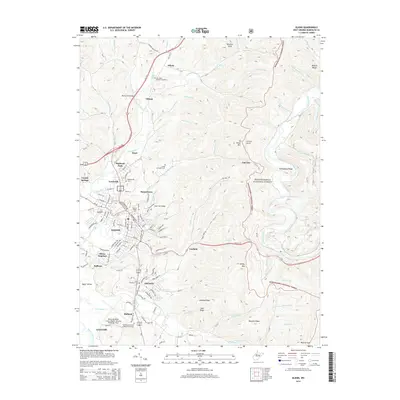
2014 Map of Elkins
USGS Topo · Published 2014About this map
The Elkins townsite and its surrounding valley floor are framed by the high ridges of the Monongahela National Forest in this 2014 survey. This region of Randolph County shows a dense concentration of educational and community landmarks, centered on the Davis & Elkins Coll campus and several significant cemeteries including Little Arlington Cem and the Independent Order of Odd Fellows Cem. The topography is defined by the Tygart Valley River and Shavers Fork, which carve through the mountainous landscape near Cheat Mtn and Bearpen Ridge. Transportation patterns are anchored by the junction of Us-33, Us-219, and the rail corridor at Elkins Junction, while smaller settlements like Highland Park, Leadsville, and Glenmore trace the residential expansion into the surrounding hillsides.
Find a feature on this map
109 named features on this map. Tap any name to fly to it.
Don’t see what you’re looking for? This feature index may not catch every label — zoom into the map to look around manually.
Map Details
Editions of this 2014 Elkins Map
This is the sole edition of this map. No revisions or reprints were ever made.
Other maps of this area

1886 · St. George
USGS Topo · 1:125,000

1889 · Beverly
USGS Topo · 1:125,000

1891 · St. George
USGS Topo · 1:125,000

1892 · Beverly
USGS Topo · 1:125,000

1907 · Belington
USGS Topo · 1:62,500

1908 · Parsons
USGS Topo · 1:62,500

1909 · Elkins
USGS Topo · 1:62,500

1922 · Horton
USGS Topo · 1:48,000

1924 · Horton
USGS Topo · 1:62,500

1926 · Parsons
USGS Topo · 1:62,500