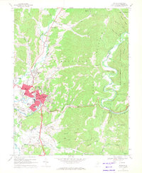
1969 Map of Elkins
USGS Topo · Published 1971About this map
The Tygart Valley River flows through the heart of this region, shaping the development of Elkins and surrounding mountain settlements during the late 1960s. As a vital transportation hub, the city is defined by the convergence of the Baltimore and Ohio Railroad and the Maryland and Western Railway, which trace the river's path and local valleys. The campus of Davis and Elkins College sits prominently on the northern edge of the city, while industrial and civic landmarks like the Elkins-Randolph County Airport and the Courthouse reflect the town's role as a county seat.
Find a feature on this map
86 named features on this map. Tap any name to fly to it.
Don’t see what you’re looking for? This feature index may not catch every label — zoom into the map to look around manually.
Map Details
Editions of this 1969 Elkins Map
2 editions found
Other maps of this area

1886 · St. George
USGS Topo · 1:125,000

1889 · Beverly
USGS Topo · 1:125,000

1891 · St. George
USGS Topo · 1:125,000

1892 · Beverly
USGS Topo · 1:125,000

1907 · Belington
USGS Topo · 1:62,500

1908 · Parsons
USGS Topo · 1:62,500

1909 · Elkins
USGS Topo · 1:62,500

1922 · Horton
USGS Topo · 1:48,000

1924 · Horton
USGS Topo · 1:62,500

1926 · Parsons
USGS Topo · 1:62,500