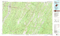
1981 Map of Elkins
USGS Topo · Published 1983About this map
Elkins serves as the focal point for this survey of the high mountain reaches where the Tygart Valley River and the Shavers Fork carve through the Allegheny Front. The landscape is defined by the heavy rail infrastructure of the Western Maryland RR and the Baltimore and Ohio RR, which supported the timber and coal industries of the era. To the west, extensive Strip Mines are visible near Coalton and Mabie, contrasting with the preserved lands of the Monongahela National Forest.
Find a feature on this map
145 named features on this map. Tap any name to fly to it.
Don’t see what you’re looking for? This feature index may not catch every label — zoom into the map to look around manually.
Map Details
Editions of this 1981 Elkins Map
This is the sole edition of this map. No revisions or reprints were ever made.
Other maps of this area

1886 · St. George
USGS Topo · 1:125,000

1889 · Beverly
USGS Topo · 1:125,000

1891 · Huntersville
USGS Topo · 1:125,000

1891 · St. George
USGS Topo · 1:125,000

1891 · Romney
USGS Topo · 1:125,000

1892 · Beverly
USGS Topo · 1:125,000

1892 · Franklin
USGS Topo · 1:125,000

1892 · Woodstock
USGS Topo · 1:125,000

1892 · Harrisonburg
USGS Topo · 1:125,000

1893 · Buckhannon
USGS Topo · 1:125,000