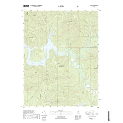
2019 Map of Elkinsville
USGS Topo · Published 2019About this map
Monroe Lake dominates the central landscape of this Brown County region, where the waters of the Middle Fork Salt Creek and South Fork Salt Creek converge. The topography is defined by a dense network of ridges and hollows, including Miller Ridge, Deckard Ridge, and Hickory Ridge, much of which is preserved within the Hoosier National Forest. The small settlement of Elkinsville sits near the eastern edge of the reservoir, served by Elkinsville Cemetery Rd and situated just north of the prominent Browning Hill.
Find a feature on this map
111 named features on this map. Tap any name to fly to it.
Don’t see what you’re looking for? This feature index may not catch every label — zoom into the map to look around manually.
Map Details
Editions of this 2019 Elkinsville Map
This is the sole edition of this map. No revisions or reprints were ever made.
Other maps of this area

1934 · Bedford
USGS Topo · 1:48,000

1937 · Bedford
USGS Topo · 1:62,500

1942 · Franklin
USGS Topo · 1:125,000

1946 · Belmont
USGS Topo · 1:24,000

1947 · Allens Creek
USGS Topo · 1:24,000

1947 · Unionville
USGS Topo · 1:24,000

1947 · Nashville
USGS Topo · 1:24,000

1947 · Elkinsville
USGS Topo · 1:24,000

1949 · Nashville
USGS Topo · 1:24,000

1950 · Belmont
USGS Topo · 1:24,000