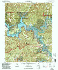
1993 Map of Elkinsville
USGS Topo · Published 1996About this map
Monroe Lake dominates the central landscape of this Brown County terrain, where the Middle Fork Salt Creek and South Fork Salt Creek converge. The topography is defined by narrow ridges and deep hollows, including Deckard Ridge, Terrill Ridge, and Hickory Ridge, much of which is protected within the Hoosier National Forest and the Charles C Deam Wilderness. The area is sparsely settled, with small communities like Elkinsville and Browning situated near the water's edge.
Find a feature on this map
61 named features on this map. Tap any name to fly to it.
Don’t see what you’re looking for? This feature index may not catch every label — zoom into the map to look around manually.
Map Details
Editions of this 1993 Elkinsville Map
This is the sole edition of this map. No revisions or reprints were ever made.
Other maps of this area

1934 · Bedford
USGS Topo · 1:48,000

1937 · Bedford
USGS Topo · 1:62,500

1942 · Franklin
USGS Topo · 1:125,000

1946 · Belmont
USGS Topo · 1:24,000

1947 · Allens Creek
USGS Topo · 1:24,000

1947 · Unionville
USGS Topo · 1:24,000

1947 · Nashville
USGS Topo · 1:24,000

1947 · Elkinsville
USGS Topo · 1:24,000

1949 · Nashville
USGS Topo · 1:24,000

1950 · Belmont
USGS Topo · 1:24,000