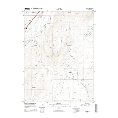
2014 Map of Elko East
USGS Topo · Published 2014About this map
The Humboldt River cuts across the northwestern corner of this Nevada landscape, where the urban expansion of Elko meets the rising terrain of the Elko Hills. By the early 21st century, the residential footprint of Spring Creek is well-established to the south, characterized by a dense grid of streets that contrast with the open, arid basins nearby. The map reveals a sophisticated water management network necessary for this high-desert environment, including the Elko Mountain Reservoir, Moffat Reservoir, and the tiered Elko Summit Reservoir Number One and Elko Summit Reservoir Number Two. Notable natural water sources like Burner Basin Spring and Tenmile Cr continue to define the drainage patterns of Burner Basin, illustrating how modern infrastructure follows the ancient paths of the Great Basin's seasonal and perennial waterways.
Find a feature on this map
122 named features on this map. Tap any name to fly to it.
Don’t see what you’re looking for? This feature index may not catch every label — zoom into the map to look around manually.
Map Details
Editions of this 2014 Elko East Map
This is the sole edition of this map. No revisions or reprints were ever made.
Other maps of this area

1952 · Dixie Flats
USGS Topo · 1:62,500

1955 · Elko
USGS Topo · 1:250,000

1957 · Elko West
USGS Topo · 1:24,000

1957 · Elko East
USGS Topo · 1:24,000

1958 · Elko
USGS Topo · 1:250,000

1962 · Elko
USGS Topo · 1:250,000

1962 · Kittridge Springs
USGS Topo · 1:24,000

1962 · Boyd Reservoir
USGS Topo · 1:24,000

1962 · Ryndon
USGS Topo · 1:24,000

1962 · Osino
USGS Topo · 1:24,000