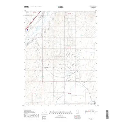
2018 Map of Elko East
USGS Topo · Published 2018About this map
Elko expansion during the late 2010s is evident in the residential street networks pushing east into the Elko Hills. This portion of northeastern Nevada is defined by a complex water management system, including the Elko Summit Reservoir Number One and Dewar Reservoir, which support the arid high-desert environment. The Humboldt River and the Union Pacific RR serve as the primary east-west corridor, following the natural break in the terrain between the hills and the South Fork Valley. Local water sources such as Burner Basin Spring and Mitchell Cr provide crucial points of reference for the surrounding grazing lands and public tracts. The map also captures the varied topography of Burner Basin and the prominence of Elko Summit, showing how transportation and infrastructure adapt to the basin-and-range geography.
Find a feature on this map
101 named features on this map. Tap any name to fly to it.
Don’t see what you’re looking for? This feature index may not catch every label — zoom into the map to look around manually.
Map Details
Editions of this 2018 Elko East Map
This is the sole edition of this map. No revisions or reprints were ever made.
Other maps of this area

1952 · Dixie Flats
USGS Topo · 1:62,500

1955 · Elko
USGS Topo · 1:250,000

1957 · Elko West
USGS Topo · 1:24,000

1957 · Elko East
USGS Topo · 1:24,000

1958 · Elko
USGS Topo · 1:250,000

1962 · Elko
USGS Topo · 1:250,000

1962 · Kittridge Springs
USGS Topo · 1:24,000

1962 · Boyd Reservoir
USGS Topo · 1:24,000

1962 · Ryndon
USGS Topo · 1:24,000

1962 · Osino
USGS Topo · 1:24,000