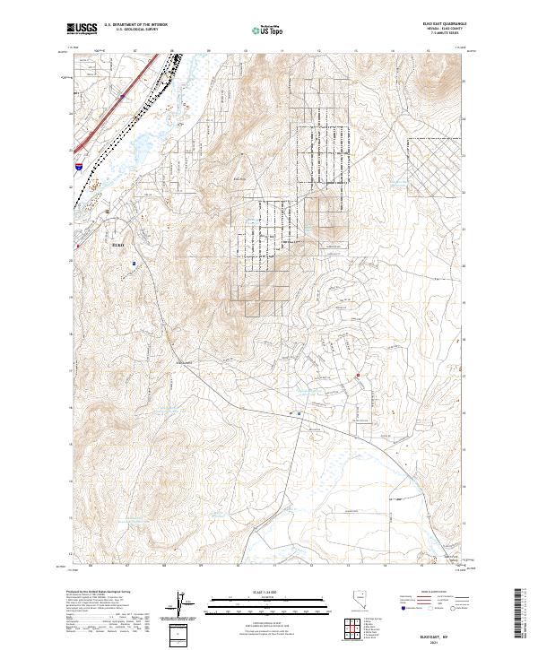
2021 Map of Elko East
USGS Topo · Published 2021About this map
Elko expansion and the critical water infrastructure of the Great Basin define this 2021 record of northeastern Nevada. The Humboldt River and the Union Pacific RR cut through the northwest corner, serving as the historical and modern arteries of the region. As the city moves eastward into the Elko Hills, the landscape is marked by a sophisticated network of water management, including the Dewar Reservoir, Elko Mountain Reservoir, and the Lamoille Highway Reservoir. These features, along with Elko Summit Reservoir Number One, highlight the ongoing engineering required to sustain growth in this arid environment. To the south, the terrain transitions toward the South Fork Valley, where smaller drainages like Tenmile Cr and Mitchell Cr flow through the high desert. This map captures the intersection of urban development and the unforgiving topography of the Elko Summit and Burner Basin.
Find a feature on this map
99 named features on this map. Tap any name to fly to it.
Don’t see what you’re looking for? This feature index may not catch every label — zoom into the map to look around manually.
Map Details
Editions of this 2021 Elko East Map
This is the sole edition of this map. No revisions or reprints were ever made.
Other maps of this area

1952 · Dixie Flats
USGS Topo · 1:62,500

1955 · Elko
USGS Topo · 1:250,000

1957 · Elko West
USGS Topo · 1:24,000

1957 · Elko East
USGS Topo · 1:24,000

1958 · Elko
USGS Topo · 1:250,000

1962 · Elko
USGS Topo · 1:250,000

1962 · Kittridge Springs
USGS Topo · 1:24,000

1962 · Boyd Reservoir
USGS Topo · 1:24,000

1962 · Ryndon
USGS Topo · 1:24,000

1962 · Osino
USGS Topo · 1:24,000