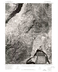
1975 Map of Elko East
USGS Topo · Published 1977About this map
The Elko townsite and its eastern expansion are captured in this mid-1970s orthophoto, showing the community as it began to climb into the nearby high ground. The Humboldt River winds through the northwest corner, a critical lifeline for this high-desert region and a primary driver for the original settlement. Unlike a traditional topographic sheet, this imagery reveals the precise layout of developing residential streets and commercial grids that were emerging south of the river at this time. The rugged topography of the Elko Hills and the prominent Elko Summit provide a stark contrast to the human footprint, while the confluence of Tenmile Creek in the southeast highlights the natural drainage patterns that have long dictated the expansion of the eastern Elko area.
Find a feature on this map
5 named features on this map. Tap any name to fly to it.
Don’t see what you’re looking for? This feature index may not catch every label — zoom into the map to look around manually.
Map Details
Editions of this 1975 Elko East Map
This is the sole edition of this map. No revisions or reprints were ever made.
Other maps of this area

1952 · Dixie Flats
USGS Topo · 1:62,500

1955 · Elko
USGS Topo · 1:250,000

1957 · Elko West
USGS Topo · 1:24,000

1957 · Elko East
USGS Topo · 1:24,000

1958 · Elko
USGS Topo · 1:250,000

1962 · Elko
USGS Topo · 1:250,000

1962 · Kittridge Springs
USGS Topo · 1:24,000

1962 · Boyd Reservoir
USGS Topo · 1:24,000

1962 · Ryndon
USGS Topo · 1:24,000

1962 · Osino
USGS Topo · 1:24,000