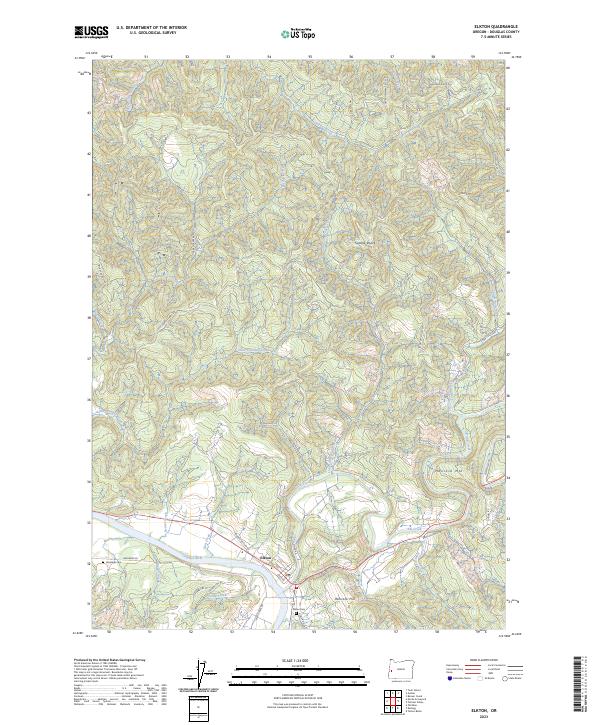
2023 Map of Elkton
USGS Topo · Published 2023About this map
The Umpqua River defines the southern reach of this landscape, where the settlement of Elkton is established at the confluence with Elk Creek. This river valley geography dictated the local infrastructure, with River Rd and Binder Section Rd following the water's edge. Family and local history is preserved at the Elkton Cem near the town center and the Henderer Cem further west along the river banks. North of the valley, the terrain rises sharply into a series of ridges and peaks including Saddle Butte, Hancock Mtn, and Hancock Hill. The map documents a network of logging and access roads like Paradise Creek Rd and Halfway Ridge Rd that thread through the timbered uplands drained by Little Paradise Creek and Beaver Creek, illustrating the intersection of the river-bottom community and the surrounding forest economy.
Find a feature on this map
48 named features on this map. Tap any name to fly to it.
Don’t see what you’re looking for? This feature index may not catch every label — zoom into the map to look around manually.
Map Details
Editions of this 2023 Elkton Map
This is the sole edition of this map. No revisions or reprints were ever made.
Other maps of this area

1942 · Crow
USGS Topo · 1:62,500

1942 · Roman Nose Mtn
USGS Topo · 1:62,500

1945 · Crow
USGS Topo · 1:62,500

1945 · Roman Nose Mtn
USGS Topo · 1:62,500

1954 · Drain
USGS Topo · 1:62,500

1955 · Elkton
USGS Topo · 1:62,500

1958 · Roseburg
USGS Topo · 1:250,000

1959 · Roseburg
USGS Topo · 1:250,000

1979 · Cottage Grove
USGS Topo · 1:100,000
1984 · Gunter
USGS Topo · 1:24,000