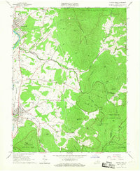
1965 Map of Elkton East
USGS Topo · Published 1967About this map
The S Fk Shenandoah River and the Norfolk and Western railroad corridor anchor the western valley floor of this mid-1960s study, where the industrial and agrarian lives of Rockingham and Page Counties meet the rising slopes of the Blue Ridge. Small communities like Elkton, Shenandoah, and Newtown are mapped in detail alongside rural centers such as Furnace and Verbena. Local genealogy is well-represented through numerous country churches and family-named landmarks, including Oak Grove Ch, Mt Paran Ch, and the Naylor Cem.
Find a feature on this map
74 named features on this map. Tap any name to fly to it.
Don’t see what you’re looking for? This feature index may not catch every label — zoom into the map to look around manually.
Map Details
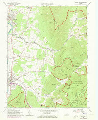
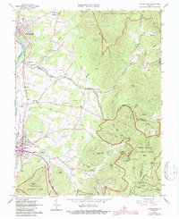
Editions of this 1965 Elkton East Map
Other maps of this area

1892 · Woodstock
USGS Topo · 1:125,000

1892 · Gordonsville
USGS Topo · 1:125,000

1892 · Harrisonburg
USGS Topo · 1:125,000

1893 · Luray
USGS Topo · 1:125,000

1905 · Luray
USGS Topo · 1:125,000

1929 · Stony Man
USGS Topo · 1:48,000

1930 · Madison
USGS Topo · 1:48,000

1933 · Stony Man
USGS Topo · 1:62,500

1933 · Madison
USGS Topo · 1:62,500

1937 · Elkton
USGS Topo · 1:62,500