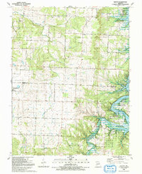
1991 Map of Elkton
USGS Topo · Published 1991About this map
Elkton and Flemington anchor this rural landscape in the early 1990s, where the boundaries of Hickory and Polk Counties meet. The eastern portion of the map is dominated by the sprawling reaches of Pomme De Terre Lake and the Pomme De Terre State Wildlife Area, reflecting a region shaped by modern conservation and water management. A notable vestige of earlier transportation is the Old Railroad Grade cutting through the western section, providing a clear path for those tracing the history of local rail infrastructure.
Find a feature on this map
30 named features on this map. Tap any name to fly to it.
Don’t see what you’re looking for? This feature index may not catch every label — zoom into the map to look around manually.
Map Details
Editions of this 1991 Elkton Map
This is the sole edition of this map. No revisions or reprints were ever made.
Other maps of this area

1884 · Bolivar
USGS Topo · 1:125,000

1886 · Stockton
USGS Topo · 1:125,000

1892 · Bolivar
USGS Topo · 1:125,000

1940 · Weaubleau
USGS Topo · 1:24,000

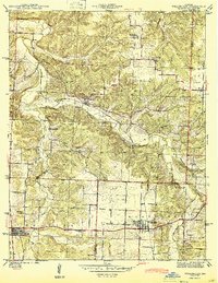
1942 · Elkton
USGS Topo · 1:24,000

1944 · Humansville
USGS Topo · 1:24,000
1944 · Weaubleau
USGS Topo · 1:24,000

1949 · Elkton
USGS Topo · 1:24,000

1949 · Sentinel
USGS Topo · 1:24,000

1950 · Elkton
USGS Topo · 1:24,000