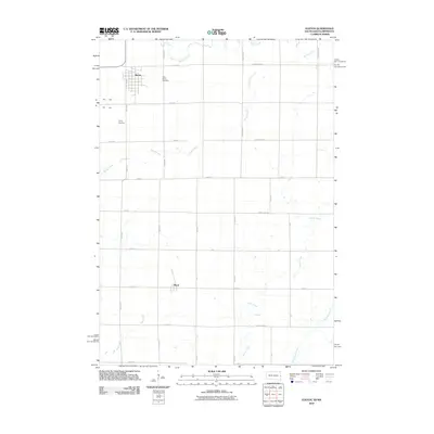
2010 Map of Elkton
USGS Topo · Published 2010About this map
The agricultural plains of Brookings County are defined by a grid of rural roads and meandering prairie waterways in this 2010 survey. The city of Elkton serves as the primary hub in the northern section of the map, while the smaller settlement of Ward anchors the southern portion. Local genealogy and burial history are preserved at Saint Marys Cemetery and Trinity Cemetery, both located near the Elkton town site. The landscape is characterized by a sophisticated drainage network including Spring Creek, Medary Creek, and Willow Creek, which wind through the sectioned farmland. These creeks, along with Flandreau Creek and Mud Creek, illustrate the hydrologic patterns of the region, where the terrain gently slopes toward the Big Sioux River basin. The intersection of local infrastructure like County HWY-10 and Cornell Ave highlights the modern connectivity of these historic farming communities.
Find a feature on this map
31 named features on this map. Tap any name to fly to it.
Don’t see what you’re looking for? This feature index may not catch every label — zoom into the map to look around manually.
Map Details
Editions of this 2010 Elkton Map
This is the sole edition of this map. No revisions or reprints were ever made.
Other maps of this area

1953 · Watertown
USGS Topo · 1:250,000

1958 · Watertown
USGS Topo · 1:250,000

1967 · Pipestone North
USGS Topo · 1:24,000

1967 · Elkton SW
USGS Topo · 1:24,000

1967 · Verdi
USGS Topo · 1:24,000

1967 · Lake Benton
USGS Topo · 1:24,000

1967 · Lake Benton SW
USGS Topo · 1:24,000

1967 · Elkton
USGS Topo · 1:24,000

1972 · Flandreau NE
USGS Topo · 1:24,000
1972 · White SE
USGS Topo · 1:24,000