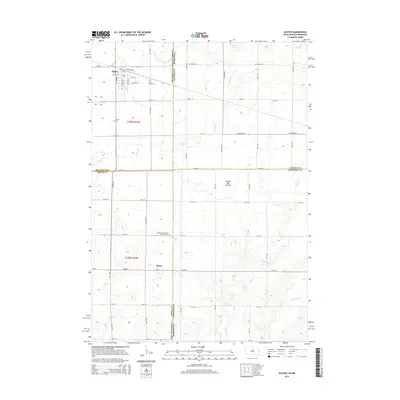
2015 Map of Elkton
USGS Topo · Published 2015About this map
Elkton and the smaller village of Ward anchor this landscape along the eastern edge of South Dakota, where the agricultural grid meets the Minnesota border. The topography is defined by the Coteau des Prairies, a high plateau that influences the drainage patterns of local waterways like Medary Cr and Spring Cr. This survey captures the rural infrastructure of Brookings and Moody Counties, showing a dense network of township roads and local avenues that connect outlying farms to the central settlements. Genealogists will find significant value in the documentation of several local burial sites, including Saint Marys Cem and Trinity Cem near the town center, as well as the German Evangelical Lutheran Cem further south. The map illustrates how these communities established themselves around the natural flow of Willow Cr and Mud Cr while following the rigid boundaries of the Public Land Survey System.
Find a feature on this map
52 named features on this map. Tap any name to fly to it.
Don’t see what you’re looking for? This feature index may not catch every label — zoom into the map to look around manually.
Map Details
Editions of this 2015 Elkton Map
This is the sole edition of this map. No revisions or reprints were ever made.
Other maps of this area

1953 · Watertown
USGS Topo · 1:250,000

1958 · Watertown
USGS Topo · 1:250,000

1967 · Pipestone North
USGS Topo · 1:24,000

1967 · Elkton SW
USGS Topo · 1:24,000

1967 · Verdi
USGS Topo · 1:24,000

1967 · Lake Benton
USGS Topo · 1:24,000

1967 · Lake Benton SW
USGS Topo · 1:24,000

1967 · Elkton
USGS Topo · 1:24,000

1972 · Flandreau NE
USGS Topo · 1:24,000
1972 · White SE
USGS Topo · 1:24,000