2013 Map of Elkton SW
USGS Topo · Published 2013About this map
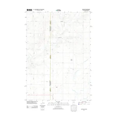
Coteau des Prairies, a massive upland plateau, dominates this landscape along the state line where Moody and Pipestone counties meet. The terrain is defined by the headwaters of the Flandreau Creek and several branches of Pipestone Creek, which carve winding paths through the high plains. The settlement of Airlie sits at the southern end of this grid, near where MN-30 and SD-34 connect the two states. Further north, the map identifies Cresson and agricultural landmarks like Cottonwood Angus Farms. This 2013 survey illustrates the enduring rural structure of the region, where the section-line road system, including 10th Ave and 487th Ave, maintains a strict geometry over the undulating glacial geography of the Coteau.
Find a feature on this map
30 named features on this map. Tap any name to fly to it.
Don’t see what you’re looking for? This feature index may not catch every label — zoom into the map to look around manually.
Map Details
Editions of this 2013 Elkton SW Map
This is the sole edition of this map. No revisions or reprints were ever made.
Other maps of this area

1953 · Watertown
USGS Topo · 1:250,000

1955 · Sioux Falls
USGS Topo · 1:250,000

1958 · Sioux Falls
USGS Topo · 1:250,000

1958 · Watertown
USGS Topo · 1:250,000

1967 · Pipestone North
USGS Topo · 1:24,000

1967 · Elkton SW
USGS Topo · 1:24,000

1967 · Verdi
USGS Topo · 1:24,000

1967 · Pipestone South
USGS Topo · 1:24,000

1967 · Jasper NW
USGS Topo · 1:24,000

1967 · Elkton
USGS Topo · 1:24,000