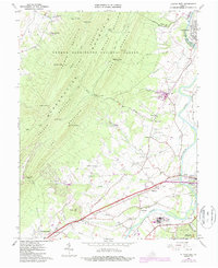
1965 Map of Elkton West
USGS Topo · Published 1987About this map
The South Fork Shenandoah River winds through the eastern valley of this mid-1960s survey, marking a distinct boundary between the high ridges of the George Washington National Forest and the agricultural lowlands. The complex topography of Massanutten Mountain dominates the western half, defined by a series of parallel ridges named First Mountain through Fourth Mountain. Between these peaks and the river, a dense network of country roads connects rural settlements and spiritual centers like Mt Sinai Ch, Bethel Ch, and Mt Zion Ch.
Find a feature on this map
64 named features on this map. Tap any name to fly to it.
Don’t see what you’re looking for? This feature index may not catch every label — zoom into the map to look around manually.
Map Details
Editions of this 1965 Elkton West Map
4 editions found
Other maps of this area

1892 · Woodstock
USGS Topo · 1:125,000

1892 · Harrisonburg
USGS Topo · 1:125,000

1937 · Elkton
USGS Topo · 1:62,500

1941 · Harrisonburg
USGS Topo · 1:62,500

1942 · Mt Jackson
USGS Topo · 1:62,500

1943 · Harrisonburg
USGS Topo · 1:62,500

1946 · Mt Jackson
USGS Topo · 1:62,500

1947 · Mt Jackson
USGS Topo · 1:62,500

1947 · Broadway
USGS Topo · 1:62,500

1949 · Charlottesville
USGS Topo · 1:250,000