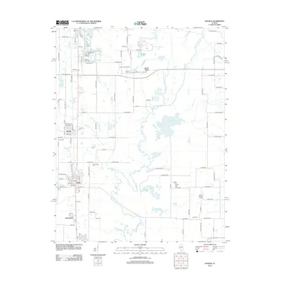
2012 Map of Elkville
USGS Topo · Published 2012About this map
The Du Quoin State Fairground anchors the northern portion of this landscape, reflecting a long-standing regional tradition of agriculture and entertainment. The surrounding terrain is defined by the winding course of the Little Muddy River and its many tributaries, including Sixmile Cr and Blacksop Cr, which have historically influenced the settlement patterns of towns like Elkville and Dowell. Numerous family and community burial grounds, such as the Old Du Quoin Cem, Davis Cem, and Dutch Hill Cem, are scattered throughout the countryside, offering significant genealogical value.
Find a feature on this map
113 named features on this map. Tap any name to fly to it.
Don’t see what you’re looking for? This feature index may not catch every label — zoom into the map to look around manually.
Map Details
Editions of this 2012 Elkville Map
This is the sole edition of this map. No revisions or reprints were ever made.
Other maps of this area

1910 · Herrin
USGS Topo · 1:62,500

1910 · Murphysboro
USGS Topo · 1:62,500

1924 · Pinckneyville
USGS Topo · 1:62,500

1926 · Pinckneyville
USGS Topo · 1:62,500

1926 · Duquoin
USGS Topo · 1:62,500

1936 · Herrin
USGS Topo · 1:62,500

1938 · Murphysboro
USGS Topo · 1:62,500

1949 · Paducah
USGS Topo · 1:250,000

1950 · Paducah
USGS Topo · 1:250,000

1954 · Paducah
USGS Topo · 1:250,000