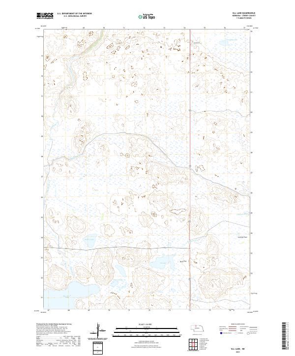
2021 Map of Ell Lake
USGS Topo · Published 2021About this map
Ell Lake and its surrounding wetlands define this portion of Cherry County, Nebraska, where water management and the natural hydrology of the Sandhills are on clear display. The Ainsworth Canal cuts across the landscape, illustrating the engineering required to move water through this sandy terrain. Numerous water bodies including Big Alkali Lake, Bakers Lake, and Rogers Lake are scattered throughout, interspersed with flatlands like Bens Flat and Lovejoy Flats. Drainage for the region is provided by local waterways such as Schlagel Cr and Evergreen Cr. The map also identifies smaller features like Coleman Pond and Lovejoy Lake, providing a clear record of the area's hydrologic profile in the early twenty-first century. This survey is particularly useful for those studying the interaction between the area's natural lake systems and modern irrigation infrastructure.
Find a feature on this map
16 named features on this map. Tap any name to fly to it.
Don’t see what you’re looking for? This feature index may not catch every label — zoom into the map to look around manually.
Map Details
Editions of this 2021 Ell Lake Map
This is the sole edition of this map. No revisions or reprints were ever made.
Other maps of this area

1950 · Sparks
USGS Topo · 1:62,500

1950 · Simeon
USGS Topo · 1:62,500

1950 · Arabia
USGS Topo · 1:62,500

1950 · Valentine
USGS Topo · 1:62,500

1957 · Valentine
USGS Topo · 1:250,000

1959 · Valentine
USGS Topo · 1:250,000

1983 · Valentine SW
USGS Topo · 1:24,000

1983 · Valentine South
USGS Topo · 1:24,000
1983 · Thatcher
USGS Topo · 1:24,000
1985 · Arabia SW
USGS Topo · 1:24,000