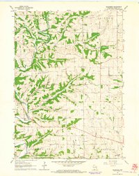
1962 Map of Ellenboro
USGS Topo · Published 1964About this map
The Platte River meanders through the heart of Grant County in this early 1960s survey, carving a landscape defined by prominent ridges and tributary branches. The settlement of Ellenboro is situated along the river's edge, serving as a focal point in a region characterized by small rural schoolhouses and country churches. The map reveals a highly localized social infrastructure, where one-room school sites like White Sch and Henry Sch still dotted the landscape alongside congregational centers such as Whig Ch and Lima-Union Ch.
Find a feature on this map
31 named features on this map. Tap any name to fly to it.
Don’t see what you’re looking for? This feature index may not catch every label — zoom into the map to look around manually.
Map Details
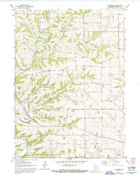
Editions of this 1962 Ellenboro Map
2 editions found
Other maps of this area

1900 · Lancaster
USGS Topo · 1:125,000

1902 · Mineral Point
USGS Topo · 1:125,000

1904 · Lancaster
USGS Topo · 1:125,000

1908 · Lancaster
USGS Topo · 1:125,000

1952 · Platteville
USGS Topo · 1:24,000

1952 · Rewey
USGS Topo · 1:24,000

1952 · Montfort
USGS Topo · 1:24,000

1957 · Potosi
USGS Topo · 1:24,000

1959 · Dubuque
USGS Topo · 1:250,000

1961 · Dubuque
USGS Topo · 1:250,000