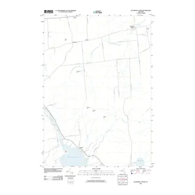
2010 Map of Ellenburg Center
USGS Topo · Published 2010About this map
Ellenburg Center and the smaller settlement of Merrill anchor this section of Clinton County, situated just inside the northeastern edge of Adirondack Park. The landscape is defined by a series of prominent peaks, including Panther Hill, Hazeltine Hill, and Cobble Hill, which rise above the complex drainage networks of the North Branch Great Chazy River and Ouleout Creek. Toward the southwest, the shoreline of Upper Chateaugay Lake is visible at Bluff Point, marking a transition from the elevated timberlands to the waterfront. Genealogists will find several burial grounds mapped, such as Star Road Cemetery, West Hill Cemetery, and Hutchins Cemetery, providing precise locations for local history research in this rural New York region.
Find a feature on this map
44 named features on this map. Tap any name to fly to it.
Don’t see what you’re looking for? This feature index may not catch every label — zoom into the map to look around manually.
Map Details
Editions of this 2010 Ellenburg Center Map
This is the sole edition of this map. No revisions or reprints were ever made.
Other maps of this area

1906 · Loon Lake
USGS Topo · 1:62,500

1908 · Loon Lake
USGS Topo · 1:62,500

1911 · Lyon Mountain
USGS Topo · 1:62,500

1913 · Lyon Mountain
USGS Topo · 1:62,500

1915 · Churubusco
USGS Topo · 1:62,500

1915 · Chateaugay
USGS Topo · 1:62,500

1931 · Lyon Mountain
USGS Topo · 1:62,500

1943 · Churubusco
USGS Topo · 1:62,500

1943 · Chateaugay
USGS Topo · 1:62,500

1948 · Ogdensburg
USGS Topo · 1:250,000