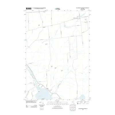
2013 Map of Ellenburg Center
USGS Topo · Published 2013About this map
The northern reaches of the Adirondack Park Preserve define the character of this landscape, where the headwaters of the N Br Great Chazy River and Ouleout Cr drain a series of prominent peaks. Small agricultural and residential clusters like Ellenburg Center and Harrigan are connected by a network of local roads such as Steam Mill Rd and Labombard Rd, reflecting the region's rural development. To the southwest, the shoreline of Upper Chateaugay Lake and the Chateaugay Narrows near Merrill indicate a shift toward seasonal recreation and water-access settlements. Genealogists will find several burial sites including W Hill Cem and Star Road Cem, which document the family names that settled these hills. The terrain is marked by numerous summits like Hazeltine Hill and Spruce Hill, showcasing the transition from high-elevation woods to the valley floors of the northern Adirondacks.
Find a feature on this map
60 named features on this map. Tap any name to fly to it.
Don’t see what you’re looking for? This feature index may not catch every label — zoom into the map to look around manually.
Map Details
Editions of this 2013 Ellenburg Center Map
This is the sole edition of this map. No revisions or reprints were ever made.
Other maps of this area

1906 · Loon Lake
USGS Topo · 1:62,500

1908 · Loon Lake
USGS Topo · 1:62,500

1911 · Lyon Mountain
USGS Topo · 1:62,500

1913 · Lyon Mountain
USGS Topo · 1:62,500

1915 · Churubusco
USGS Topo · 1:62,500

1915 · Chateaugay
USGS Topo · 1:62,500

1931 · Lyon Mountain
USGS Topo · 1:62,500

1943 · Churubusco
USGS Topo · 1:62,500

1943 · Chateaugay
USGS Topo · 1:62,500

1948 · Ogdensburg
USGS Topo · 1:250,000