
1944 Map of Ellenton
USGS Topo · Published 1944About this map
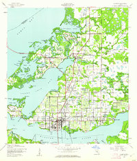
The Manatee River shoreline and the intricate wetlands of Tampa Bay dominate this 1944 survey, capturing the coastal development of Manatee County during the mid-war years. The urban centers of Palmetto and Bradenton are connected by the Green Bridge, while the Tamiami Trail provides a primary inland artery for the region. Significant land use is evident at Fullers Earth, suggesting the importance of clay mining to the local economy.
Find a feature on this map
89 named features on this map. Tap any name to fly to it.
Don’t see what you’re looking for? This feature index may not catch every label — zoom into the map to look around manually.
Map Details
Editions of this 1944 Ellenton Map
2 editions found
Other maps of this area

1921 · Fort De Soto
USGS Topo · 1:62,500

1942 · Cockroach Bay
USGS Topo · 1:31,680

1943 · Pass-A-Grille
USGS Topo · 1:31,680

1944 · Anna Maria
USGS Topo · 1:31,680

1944 · Ruskin
USGS Topo · 1:31,680

1944 · Lorraine
USGS Topo · 1:31,680

1944 · Parish
USGS Topo · 1:31,680

1944 · Bradenton Beach
USGS Topo · 1:31,680

1945 · Cockroach Bay
USGS Topo · 1:31,680
1947 · Cockroach Bay
USGS Topo · 1:25,000