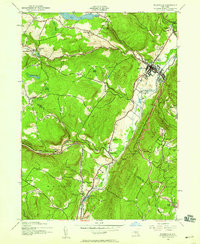
1942 Map of Ellenville
USGS Topo · Published 1959About this map
Ellenville and its surrounding valleys are defined by the convergence of industrial transport corridors during the mid-20th century. The village serves as a central hub where the New York Ontario and Western RR tracks parallel the visible remains of the New York Ontario and Western Canal (Abandoned), tracing the natural path of Sandburg Creek and Homowack Creek. This overlap of water-borne and rail commerce illustrates the region's transition from 19th-century logistics to modern infrastructure.
Find a feature on this map
43 named features on this map. Tap any name to fly to it.
Don’t see what you’re looking for? This feature index may not catch every label — zoom into the map to look around manually.
Map Details
Editions of this 1942 Ellenville Map
2 editions found
Other maps of this area

1903 · Slide Mountain
USGS Topo · 1:62,500

1904 · Ellenville
USGS Topo · 1:62,500

1905 · Slide Mountain
USGS Topo · 1:62,500

1906 · Ellenville
USGS Topo · 1:62,500

1909 · Monticello
USGS Topo · 1:62,500

1910 · Neversink
USGS Topo · 1:62,500

1911 · Monticello
USGS Topo · 1:62,500

1942 · Neversink
USGS Topo · 1:62,500

1942 · Lackawack
USGS Topo · 1:24,000

1942 · Kerhonkson
USGS Topo · 1:24,000