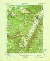
1943 Map of Ellenville
USGS Topo · Published 1943About this map
Ellenville and the surrounding Shawangunk valley appear here in a wartime 1943 survey, capturing the industrial and transport infrastructure of eastern New York before post-war expansion. The village is anchored by the Pepsi Cola Bottling Co and the Veterans Memorial Hospital, with the New York Ontario and Western railroad cutting through the valley floor. A notable historical relic is the Delaware and Hudson Canal, which parallels Rondout Creek and Sandburg Creek, marking the nineteenth-century corridor that shaped the region's early growth.
Find a feature on this map
46 named features on this map. Tap any name to fly to it.
Don’t see what you’re looking for? This feature index may not catch every label — zoom into the map to look around manually.
Map Details
Editions of this 1943 Ellenville Map
This is the sole edition of this map. No revisions or reprints were ever made.
Other maps of this area

1903 · Slide Mountain
USGS Topo · 1:62,500

1904 · Ellenville
USGS Topo · 1:62,500

1905 · Slide Mountain
USGS Topo · 1:62,500

1906 · Ellenville
USGS Topo · 1:62,500

1909 · Monticello
USGS Topo · 1:62,500

1910 · Neversink
USGS Topo · 1:62,500

1911 · Monticello
USGS Topo · 1:62,500

1942 · Neversink
USGS Topo · 1:62,500

1942 · Lackawack
USGS Topo · 1:24,000

1942 · Kerhonkson
USGS Topo · 1:24,000