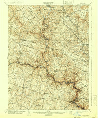
1906 Map of Ellicott
USGS Topo · Published 1942About this map
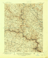
Patapsco River and its numerous branches carve through the landscape of Howard, Carroll, and Baltimore Counties at the start of the twentieth century. This area is defined by a transition from traditional rural estates like the expansive Doughoregan Manor to the early industrial and institutional growth seen at Ellicott City. The map documents a dense network of early transport, including the Western Maryland RR and the Emory Grove Electric RR, which served developing communities like Reisterstown and Owings Mills. Notable landmarks of the era are clearly marked, such as St Charles College, the McDonogh School, and the sprawling Springfield Hospital grounds. From the serpentine course of Morgan Run to the open stretches of Worthington Valley, the survey illustrates how the region's diverse topography dictated the placement of historic turnpikes and turn-of-the-century settlements.
Find a feature on this map
99 named features on this map. Tap any name to fly to it.
Don’t see what you’re looking for? This feature index may not catch every label — zoom into the map to look around manually.
Map Details
Editions of this 1906 Ellicott Map
6 editions found

Other maps of this area

1892 · Laurel
USGS Topo · 1:62,500

1892 · Ellicott
USGS Topo · 1:62,500

1893 · Frederick
USGS Topo · 1:125,000

1894 · Ellicott
USGS Topo · 1:62,500

1894 · Laurel
USGS Topo · 1:62,500

1894 · Baltimore
USGS Topo · 1:62,500

1894 · Frederick
USGS Topo · 1:125,000

1894 · Relay
USGS Topo · 1:62,500

1897 · Laurel
USGS Topo · 1:62,500

1899 · Baltimore
USGS Topo · 1:62,500