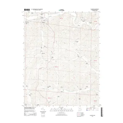
2015 Map of Ellington
USGS Topo · Published 2015About this map
Ellington serves as the focal point of this Reynolds County landscape, where the local road network converges among a high concentration of family and community burial grounds. This 2015 data reflects the enduring layout of the region's rural settlements, from the residential blocks of the town center to smaller outlying locales like Chitwood, Oakley, and Ruble. The geography is defined by a dense network of named hollows and valleys, including Dickson Valley and McMillen Hollow, which channel local waterways like Logan Cr and Doe Run Cr. Notable for genealogists, the map identifies numerous specific sites such as Ellington Memorial Cemetery, Newton Cemetery, and the Bethlehem Cemetery located near Grady. These landmarks, along with springs like Ball Spring and Morris Spring, highlight the traditional reliance on specific topographical features for both settlement and water access in this part of the Ozarks.
Find a feature on this map
91 named features on this map. Tap any name to fly to it.
Don’t see what you’re looking for? This feature index may not catch every label — zoom into the map to look around manually.
Map Details
Editions of this 2015 Ellington Map
This is the sole edition of this map. No revisions or reprints were ever made.
Other maps of this area

1928 · Cardareva
USGS Topo · 1:62,500

1943 · Ellington
USGS Topo · 1:62,500

1943 · Lesterville
USGS Topo · 1:62,500

1944 · Corridon
USGS Topo · 1:62,500

1945 · Ellington
USGS Topo · 1:62,500

1946 · Lesterville
USGS Topo · 1:62,500

1947 · Corridon
USGS Topo · 1:62,500

1949 · Rolla
USGS Topo · 1:250,000

1949 · Cardareva
USGS Topo · 1:62,500

1953 · Rolla
USGS Topo · 1:250,000