
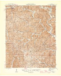
1945 Map of Ellington
USGS Topo · Published 1945About this map
Ellington serves as the primary hub in this Ozark landscape, situated near the headwaters of Logan Creek. The 1943 survey captures the area just as the Clearwater Dam on the Black River was altering the regional hydrology, while the interior remains a densely wooded network of hollows and ridges. Rural life is anchored by family-named schools and churches, including the Yount Memorial Sch and Bethlehem Ch. The western portion of the map is dominated by the Deer Run State Park, which includes the prominent Deer Run Firetower, a critical piece of mid-century forestry infrastructure. Small agrarian clusters like Garwood and Riverside are connected by winding valley roads that trace the topography of Keala Valley and Webb Valley, illustrating a settlement pattern dictated by the drainage of the North Fork Logan Creek and its many branches.
Find a feature on this map
57 named features on this map. Tap any name to fly to it.
Don’t see what you’re looking for? This feature index may not catch every label — zoom into the map to look around manually.
Map Details
Editions of this 1945 Ellington Map
2 editions found
Other maps of this area

1926 · Des Arc
USGS Topo · 1:62,500

1928 · Cardareva
USGS Topo · 1:62,500

1929 · Des Arc
USGS Topo · 1:62,500

1932 · Piedmont
USGS Topo · 1:62,500

1934 · Williamsville
USGS Topo · 1:48,000

1935 · Piedmont
USGS Topo · 1:62,500

1940 · Williamsville
USGS Topo · 1:62,500

1943 · Ellington
USGS Topo · 1:62,500

1943 · Lesterville
USGS Topo · 1:62,500

1944 · Van Buren
USGS Topo · 1:62,500