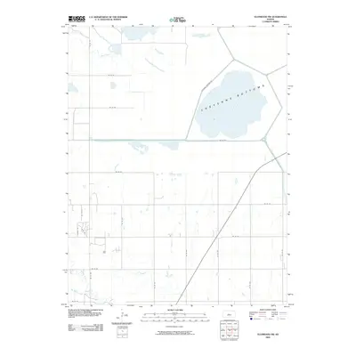
2009 Map of Ellinwood NW
USGS Topo · Published 2009About this map
Cheyenne Bottoms dominates the northeastern landscape of this Barton County quadrangle, showing the expansive wetland basin during the early twenty-first century. This unique geological depression, one of the most significant inland marsh systems in the United States, is shown with its surrounding infrastructure, including Cheyenne Bottoms Rd. The drainage pattern is defined by several watercourses that feed into or bypass the basin, such as Blood Creek and Little Cheyenne Creek. To the southwest, the terrain transitions toward the fertile valleys of Walnut Creek and Dry Walnut Creek. The land is divided into a precise grid of rural roads, with many like Ne 80 RD and NE 20 Ave following section lines typical of the Kansas agricultural landscape. While primarily rural, small residential clusters or landmarks are indicated by labels such as Sunset Rd and Point Dr.
Find a feature on this map
24 named features on this map. Tap any name to fly to it.
Don’t see what you’re looking for? This feature index may not catch every label — zoom into the map to look around manually.
Map Details
Editions of this 2009 Ellinwood NW Map
This is the sole edition of this map. No revisions or reprints were ever made.
Other maps of this area

1891 · Great Bend
USGS Topo · 1:125,000

1893 · Great Bend
USGS Topo · 1:125,000

1896 · Russell
USGS Topo · 1:125,000

1955 · Great Bend
USGS Topo · 1:250,000

1956 · Ellinwood NE
USGS Topo · 1:24,000

1956 · Ellinwood NW
USGS Topo · 1:24,000

1957 · Great Bend
USGS Topo · 1:250,000

1957 · Ellinwood SW
USGS Topo · 1:24,000

1957 · Ellinwood
USGS Topo · 1:24,000

1958 · Great Bend
USGS Topo · 1:250,000