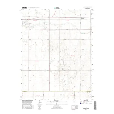
2015 Map of Ellinwood SW
USGS Topo · Published 2015About this map
Arkansas River and Walnut Cr define the northern landscape of this region, where the southeastern edge of Great Bend gives way to the open agricultural tracts of central Kansas. The transition from the urban grid of Great Bend—marked by streets like Chestnut St and Barton Dr—to the expansive section-line road network highlights the late 20th-century development patterns at the county line. The small settlement of Dartmouth sits at a rail and road junction to the northeast, anchoring a rural landscape crisscrossed by named routes such as E Barton Co Rd and Comanche Rd. Spanning the Barton Co Stafford Co border, this survey documents the hydrography and topography of the alluvial plains as they appeared in 2015, preserving the alignment of local connectors like 70 Se Rd before they meet the southern prairie.
Find a feature on this map
56 named features on this map. Tap any name to fly to it.
Don’t see what you’re looking for? This feature index may not catch every label — zoom into the map to look around manually.
Map Details
Editions of this 2015 Ellinwood SW Map
This is the sole edition of this map. No revisions or reprints were ever made.
Other maps of this area

1891 · Great Bend
USGS Topo · 1:125,000

1893 · Great Bend
USGS Topo · 1:125,000

1955 · Great Bend
USGS Topo · 1:250,000

1956 · Ellinwood NE
USGS Topo · 1:24,000

1956 · Ellinwood NW
USGS Topo · 1:24,000

1957 · Great Bend
USGS Topo · 1:250,000

1957 · Ellinwood SW
USGS Topo · 1:24,000

1957 · Ellinwood
USGS Topo · 1:24,000

1958 · Great Bend
USGS Topo · 1:250,000

1958 · Great Bend
USGS Topo · 1:24,000