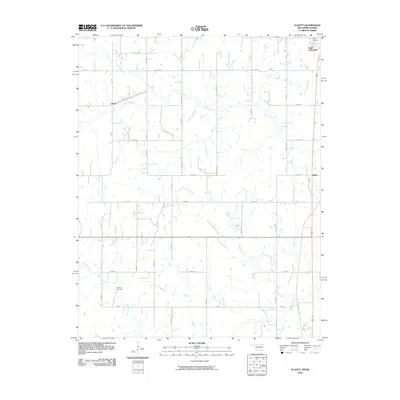
2010 Map of Elliott
USGS Topo · Published 2010About this map
South Coffeyville anchors the northeastern corner of this Nowata County landscape, where the Oklahoma-Kansas state line divides the rural plains. The area is defined by a dendritic network of seasonal and permanent waterways, including the winding Opossum Creek and Hickory Creek, which dictate the placement of the sparse local road network. Smaller settlements like Noxie and Elliott serve as local landmarks within this predominantly agricultural setting. Genealogists and local historians can find specifically marked burial sites, such as Calvary Cemetery near the Kansas border and the more remote Steward Cemetery to the south. The map illustrates a transitional period in the early 21st century where traditional section lines like Ew 06 RD and Ew 09 intersect with modern geographic data, preserving the locations of these small communities and family-named landmarks.
Find a feature on this map
21 named features on this map. Tap any name to fly to it.
Don’t see what you’re looking for? This feature index may not catch every label — zoom into the map to look around manually.
Map Details
Editions of this 2010 Elliott Map
This is the sole edition of this map. No revisions or reprints were ever made.
Other maps of this area

1886 · Independence
USGS Topo · 1:125,000

1894 · Independence
USGS Topo · 1:125,000

1901 · Nowata
USGS Topo · 1:125,000

1905 · Independence
USGS Topo · 1:125,000

1914 · Nowata
USGS Topo · 1:125,000

1947 · Joplin
USGS Topo · 1:250,000

1949 · Joplin
USGS Topo · 1:250,000

1954 · Tulsa
USGS Topo · 1:250,000

1954 · Joplin
USGS Topo · 1:250,000

1958 · Joplin
USGS Topo · 1:250,000