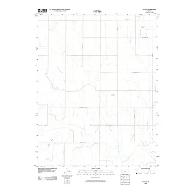
2009 Map of Ellis SE
USGS Topo · Published 2009About this map
The Smoky Hill River meanders across this rural section of Ellis County, defining the drainage patterns for the surrounding agricultural and industrial landscape. The map captures a grid of section roads including Butterfield Trail Rd, a name recalling the historic overland stage route that once traversed the central plains. This 2009 survey documents the active energy extraction of the era, noting the Pleasant West Oil Field in the north and the Solburn Oil Field centrally located. Topographical features like Wildon Draw break the otherwise orderly township lines, while Rohr-Jacobs Lake provides a rare persistent water body in the southeastern quadrant. The local road network, from Antonino Rd to Munjor Rd, provides clear orientation for family researchers tracing property lines in the vicinity of local communities just off the map's edge.
Find a feature on this map
19 named features on this map. Tap any name to fly to it.
Don’t see what you’re looking for? This feature index may not catch every label — zoom into the map to look around manually.
Map Details
Editions of this 2009 Ellis SE Map
This is the sole edition of this map. No revisions or reprints were ever made.
Other maps of this area

1893 · Ellis
USGS Topo · 1:125,000

1896 · Hays
USGS Topo · 1:125,000

1955 · Great Bend
USGS Topo · 1:250,000

1957 · Great Bend
USGS Topo · 1:250,000

1958 · Great Bend
USGS Topo · 1:250,000

1961 · Yocemento
USGS Topo · 1:24,000
1961 · Ogallah
USGS Topo · 1:24,000

1961 · Antonino
USGS Topo · 1:24,000
1961 · Ellis
USGS Topo · 1:24,000
1968 · La Crosse NW
USGS Topo · 1:24,000