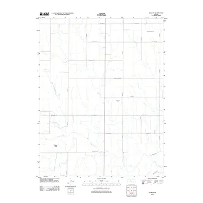
2012 Map of Ellis SE
USGS Topo · Published 2012About this map
The Smoky Hill River meanders through the southern portion of this Ellis County landscape, carving a distinct path through the High Plains terrain. The area is defined by its agricultural and industrial heritage, notably marked by energy extraction at the Pleasant West Oil Field in the northeast and the Solburn Oil Field further south. These fields represent the long-standing petroleum economy that has shaped this part of Kansas for decades.
Find a feature on this map
18 named features on this map. Tap any name to fly to it.
Don’t see what you’re looking for? This feature index may not catch every label — zoom into the map to look around manually.
Map Details
Editions of this 2012 Ellis SE Map
This is the sole edition of this map. No revisions or reprints were ever made.
Other maps of this area

1893 · Ellis
USGS Topo · 1:125,000

1896 · Hays
USGS Topo · 1:125,000

1955 · Great Bend
USGS Topo · 1:250,000

1957 · Great Bend
USGS Topo · 1:250,000

1958 · Great Bend
USGS Topo · 1:250,000

1961 · Yocemento
USGS Topo · 1:24,000
1961 · Ogallah
USGS Topo · 1:24,000

1961 · Antonino
USGS Topo · 1:24,000
1961 · Ellis
USGS Topo · 1:24,000
1968 · La Crosse NW
USGS Topo · 1:24,000