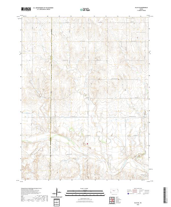
2022 Map of Ellis SE
USGS Topo · Published 2022About this map
The Smoky Hill River winds through the southern portion of this landscape, carving a path through the High Plains terrain on the border of Trego and Ellis counties. This modern topographic study reveals a rural grid of section lines and named local routes that speak to the region's historical ranching and transport heritage. Of particular interest to local historians is the alignment of Butterfield Trail Rd, which follows a legendary route across the Kansas prairie. To the west, the drainage of Wildon Draw feeds into the river valley, illustrating the natural watershed patterns of the area. The map identifies several family and local landmarks through road names such as Grants Villa Rd, Chetolah Gold Rd, and Munjor Rd, reflecting the enduring settlement patterns and township divisions of the Smoky Hill trail corridor.
Find a feature on this map
24 named features on this map. Tap any name to fly to it.
Don’t see what you’re looking for? This feature index may not catch every label — zoom into the map to look around manually.
Map Details
Editions of this 2022 Ellis SE Map
This is the sole edition of this map. No revisions or reprints were ever made.
Other maps of this area

1893 · Ellis
USGS Topo · 1:125,000

1896 · Hays
USGS Topo · 1:125,000

1955 · Great Bend
USGS Topo · 1:250,000

1957 · Great Bend
USGS Topo · 1:250,000

1958 · Great Bend
USGS Topo · 1:250,000

1961 · Yocemento
USGS Topo · 1:24,000
1961 · Ogallah
USGS Topo · 1:24,000

1961 · Antonino
USGS Topo · 1:24,000
1961 · Ellis
USGS Topo · 1:24,000
1968 · La Crosse NW
USGS Topo · 1:24,000