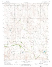
1974 Map of Ellis SE
USGS Topo · Published 1977About this map
The Butterfield Trail and the Approximate Overland Trail cut across this High Plains landscape, marking historic transportation routes that once linked the frontier. The mid-1970s terrain is defined by the winding course of the Smoky Hill River and an extensive network of industrial development. Energy extraction is prominent throughout the region, with the West Ellis Oil Field, Solburn Oil Field, and Groff Oil Field showing numerous active Oil Wells.
Find a feature on this map
19 named features on this map. Tap any name to fly to it.
Don’t see what you’re looking for? This feature index may not catch every label — zoom into the map to look around manually.
Map Details
Editions of this 1974 Ellis SE Map
This is the sole edition of this map. No revisions or reprints were ever made.
Other maps of this area

1893 · Ellis
USGS Topo · 1:125,000

1896 · Hays
USGS Topo · 1:125,000

1955 · Great Bend
USGS Topo · 1:250,000

1957 · Great Bend
USGS Topo · 1:250,000

1958 · Great Bend
USGS Topo · 1:250,000

1961 · Yocemento
USGS Topo · 1:24,000
1961 · Ogallah
USGS Topo · 1:24,000

1961 · Antonino
USGS Topo · 1:24,000
1961 · Ellis
USGS Topo · 1:24,000
1968 · La Crosse NW
USGS Topo · 1:24,000