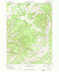
1969 Map of Ellisburg
USGS Topo · Published 1972About this map
The Underground Gas Storage Field defines much of the industrial character of this region along the New York Pennsylvania border. This 1969 survey reveals a landscape of deep valleys and ridges where the extraction industry left a significant footprint, marked by numerous Gas Wells, Oil Wells, and several Compressor Stations. The small hamlets of Ellisburg and Andrews Settlement serve as local hubs, with the latter featuring the Union Ch and Andrews Settlement Cem. Geographers and local historians can trace the transition from rail to road transportation, as the Old Oswayo Railroad Grade follows the path of Oswayo Creek through the western hills. To the east, the headwaters of the Genesee River flow through Irish Settlement Brook, while natural features like Rose Lake and family-named landmarks such as Carmer Hill and Peet Hill anchor the rural landscape.
Find a feature on this map
47 named features on this map. Tap any name to fly to it.
Don’t see what you’re looking for? This feature index may not catch every label — zoom into the map to look around manually.
Map Details
Editions of this 1969 Ellisburg Map
3 editions found
Other maps of this area

1925 · Belmont
USGS Topo · 1:62,500

1926 · Wellsville
USGS Topo · 1:62,500

1932 · Genesee
USGS Topo · 1:62,500

1934 · Coudersport
USGS Topo · 1:48,000

1937 · Genesee
USGS Topo · 1:62,500

1938 · Coudersport
USGS Topo · 1:62,500

1939 · Belmont
USGS Topo · 1:62,500

1950 · Elmira
USGS Topo · 1:250,000

1954 · Williamsport
USGS Topo · 1:250,000

1957 · Warren
USGS Topo · 1:250,000