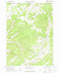
1969 Map of Ellisburg
USGS Topo · Published 1976About this map
Ellisburg and Andrews Settlement anchor this 1969 topographic portrait of the rural hills along the Pennsylvania-New York border. The landscape is defined by the headwaters of two major watersheds: the Genesee River flowing north and Oswayo Creek trending southwest. This era in Potter County is marked by extensive energy infrastructure, visible through numerous Gas Wells and an expansive Underground Storage Field near Reynoldstown.
Find a feature on this map
51 named features on this map. Tap any name to fly to it.
Don’t see what you’re looking for? This feature index may not catch every label — zoom into the map to look around manually.
Map Details
Editions of this 1969 Ellisburg Map
3 editions found
Other maps of this area

1925 · Belmont
USGS Topo · 1:62,500

1926 · Wellsville
USGS Topo · 1:62,500

1932 · Genesee
USGS Topo · 1:62,500

1934 · Coudersport
USGS Topo · 1:48,000

1937 · Genesee
USGS Topo · 1:62,500

1938 · Coudersport
USGS Topo · 1:62,500

1939 · Belmont
USGS Topo · 1:62,500

1950 · Elmira
USGS Topo · 1:250,000

1954 · Williamsport
USGS Topo · 1:250,000

1957 · Warren
USGS Topo · 1:250,000