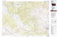
1975 Map of Elliston
USGS Topo · Published 1993About this map
The Continental Divide serves as the literal and topographic backbone of this mid-1970s Montana landscape, separating the headwaters of the Blackfoot River from the Missouri River drainage. High-altitude mining history is etched into the terrain at the Swansea Mine and Carbonate King Mine, while the Fort William Henry Harrison military reservation dominates the eastern approach near the state capital's periphery.
Find a feature on this map
54 named features on this map. Tap any name to fly to it.
Don’t see what you’re looking for? This feature index may not catch every label — zoom into the map to look around manually.
Map Details
Editions of this 1975 Elliston Map
This is the sole edition of this map. No revisions or reprints were ever made.
Other maps of this area

1886 · Great Falls
USGS Topo · 1:250,000

1886 · Fort Logan
USGS Topo · 1:250,000

1889 · Helena
USGS Topo · 1:250,000

1893 · Helena
USGS Topo · 1:250,000

1899 · Boulder
USGS Topo · 1:125,000

1899 · Helena
USGS Topo · 1:62,500

1899 · Helena
USGS Topo · 1:250,000

1902 · Ovando
USGS Topo · 1:125,000

1903 · Coopers Lake
USGS Topo · 1:125,000

1903 · Helena
USGS Topo · 1:250,000