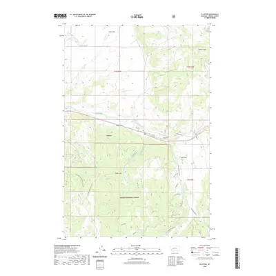
2020 Map of Elliston
USGS Topo · Published 2020About this map
Elliston lies at the heart of this landscape where the Little Blackfoot River meets Dog Cr, serving as a central point for the surrounding mountainous terrain. The settlement pattern follows the river valley, flanked by the steep draws of Kinney Gulch and Logan Gulch. This 2020 map details the transition from the concentrated corridor of W Main St and E Front St into the expansive wildlands of the Helena National Forest. To the south, high-elevation water bodies like Lilly Lake and Slate Lake are reached by a network of forest roads, including Elliston Gulch Rd and Natl Forest Develop Road 314 Rd. The proximity of landmarks such as Mike Renig Gulch and the local Wood Strip reflects a landscape defined by both timber history and modern backcountry access.
Find a feature on this map
38 named features on this map. Tap any name to fly to it.
Don’t see what you’re looking for? This feature index may not catch every label — zoom into the map to look around manually.
Map Details
Editions of this 2020 Elliston Map
This is the sole edition of this map. No revisions or reprints were ever made.
Other maps of this area

1889 · Helena
USGS Topo · 1:250,000

1893 · Helena
USGS Topo · 1:250,000

1899 · Boulder
USGS Topo · 1:125,000

1899 · Helena
USGS Topo · 1:250,000

1903 · Helena
USGS Topo · 1:250,000

1947 · Butte
USGS Topo · 1:250,000

1954 · Basin
USGS Topo · 1:62,500

1958 · Butte
USGS Topo · 1:250,000

1958 · Avon
USGS Topo · 1:62,500

1959 · Deer Lodge
USGS Topo · 1:62,500