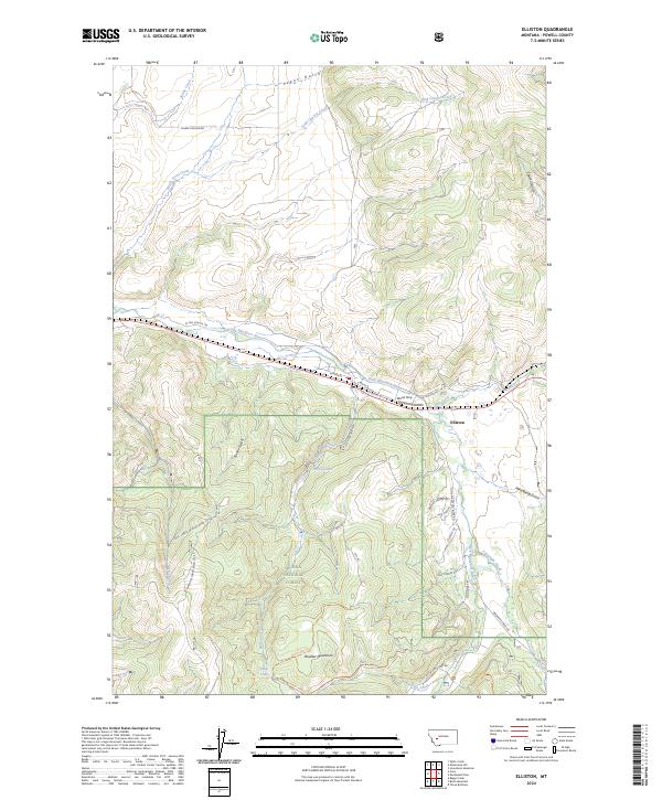
2024 Map of Elliston
USGS Topo · Published 2024About this map
Elliston serves as the primary settlement on this map, situated where the Little Blackfoot River meets Dog Creek. The landscape transition is evident between the residential streets of Wood Strip and the protected lands of the Helena National Forest. To the south, the Boulder Mountains dominate the terrain, harboring secluded high-elevation water bodies like Lilly Lake and Slate Lake. The transport network follows the river valley, with the historic W Old Mullen Trl and Old Mullan Trl tracing the paths used by early travelers across the Continental Divide. Numerous drainages such as Kinney Gulch and Mike Renig Gulch carve into the mountain slopes, indicating a terrain defined by narrow valleys and seasonal water flows. This modern survey provides an accurate view of current road access into the forest, including Natl Forest Develop Road 314 Rd and the Slate Lake Trl.
Find a feature on this map
40 named features on this map. Tap any name to fly to it.
Don’t see what you’re looking for? This feature index may not catch every label — zoom into the map to look around manually.
Map Details
Editions of this 2024 Elliston Map
This is the sole edition of this map. No revisions or reprints were ever made.
Other maps of this area

1889 · Helena
USGS Topo · 1:250,000

1893 · Helena
USGS Topo · 1:250,000

1899 · Boulder
USGS Topo · 1:125,000

1899 · Helena
USGS Topo · 1:250,000

1903 · Helena
USGS Topo · 1:250,000

1947 · Butte
USGS Topo · 1:250,000

1954 · Basin
USGS Topo · 1:62,500

1958 · Butte
USGS Topo · 1:250,000

1958 · Avon
USGS Topo · 1:62,500

1959 · Deer Lodge
USGS Topo · 1:62,500