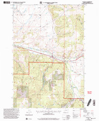
2001 Map of Elliston
USGS Topo · Published 2004About this map
Elliston serves as the central hub of this Powell County survey, situated at the confluence of several vital watercourses including the Little Blackfoot River and Dog Creek. The landscape is defined by the heavy timber of the Helena National Forest and the administrative oversight of the Helena Ranger District. Evidence of industrial history is scattered throughout the drainages, notably with the Carbonate King Mine and various prospects, adits, and a mine shaft that point to the region's mineral extraction heritage. High-altitude features like Lily Lake and Slate Lake are tucked into the drainages of Elliston Creek and Slate Creek. Transportation and infrastructure are represented by a major pipeline and numerous 4wd tracks that penetrate the gulches, while community landmarks like Camp Child, Sunshine Camp, and a local Cem provide important genealogical and social reference points.
Find a feature on this map
33 named features on this map. Tap any name to fly to it.
Don’t see what you’re looking for? This feature index may not catch every label — zoom into the map to look around manually.
Map Details
Editions of this 2001 Elliston Map
This is the sole edition of this map. No revisions or reprints were ever made.
Other maps of this area

1889 · Helena
USGS Topo · 1:250,000

1893 · Helena
USGS Topo · 1:250,000

1899 · Boulder
USGS Topo · 1:125,000

1899 · Helena
USGS Topo · 1:250,000

1903 · Helena
USGS Topo · 1:250,000

1947 · Butte
USGS Topo · 1:250,000

1954 · Basin
USGS Topo · 1:62,500

1958 · Butte
USGS Topo · 1:250,000

1958 · Avon
USGS Topo · 1:62,500

1959 · Deer Lodge
USGS Topo · 1:62,500