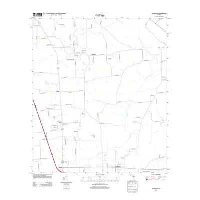
2012 Map of Ellisville
USGS Topo · Published 2012About this map
Ebenezer and Ellisville anchor this northern Florida landscape, characterized by a dense network of country roads and scattered family cemeteries. The region is defined by the flow of Olustee Cr, Rose Cr, and Swift Cr, which cut through the level terrain. Genealogists will find a high concentration of burial sites, including the Mount Tabor African Methodist Episcopal Cem and Hopeful Church Cem, indicating deep-rooted community foundations. Civil aviation and fire detection are represented by the Lake City Airpark and the Rose Creek Lookout Tower. The southern portion of the sheet transitions toward recreation at Camp O the Suwannee, while small hubs like Mason and Providence serve as local landmarks along the transit corridors.
Find a feature on this map
99 named features on this map. Tap any name to fly to it.
Don’t see what you’re looking for? This feature index may not catch every label — zoom into the map to look around manually.
Map Details
Editions of this 2012 Ellisville Map
This is the sole edition of this map. No revisions or reprints were ever made.
Other maps of this area

1954 · Gainesville
USGS Topo · 1:250,000

1954 · Valdosta
USGS Topo · 1:250,000

1958 · Valdosta
USGS Topo · 1:250,000

1958 · Gainesville
USGS Topo · 1:250,000

1959 · Valdosta
USGS Topo · 1:250,000

1959 · Gainesville
USGS Topo · 1:250,000

1962 · Lake City East
USGS Topo · 1:24,000

1962 · Mikesville
USGS Topo · 1:24,000

1963 · Olustee
USGS Topo · 1:24,000

1963 · Ellisville
USGS Topo · 1:24,000