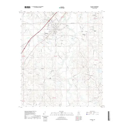
2018 Map of Ellisville
USGS Topo · Published 2018About this map
Ellisville serves as a central hub for Jones County in this detailed study, where the Norfolk Southern railroad line cuts through the heart of the settlement. The landscape is defined by the branching tributaries of Tallala Creek and Rocky Cr, which wind through a patchwork of rural homesteads and named communities. Educational and social institutions like Jones County Jr College and Ellisville School indicate the town's role as a regional center, while the surrounding countryside is dotted with small settlements such as Jenkins, Pecan Grove, and Oak Grove.
Find a feature on this map
125 named features on this map. Tap any name to fly to it.
Don’t see what you’re looking for? This feature index may not catch every label — zoom into the map to look around manually.
Map Details
Editions of this 2018 Ellisville Map
This is the sole edition of this map. No revisions or reprints were ever made.
Other maps of this area

1953 · Hattiesburg
USGS Topo · 1:250,000

1958 · Hattiesburg
USGS Topo · 1:250,000

1963 · Barrontown
USGS Topo · 1:24,000

1964 · Laurel East
USGS Topo · 1:24,000

1964 · Laurel West
USGS Topo · 1:24,000

1964 · Ovett
USGS Topo · 1:24,000

1964 · Ellisville
USGS Topo · 1:24,000

1964 · Lanham
USGS Topo · 1:24,000

1965 · Hebron
USGS Topo · 1:24,000

1965 · Eastabuchie
USGS Topo · 1:24,000